
All the maps are available on the office servers... but, and it's a big but... serving them over the internet, given their size (1-3MB) and the overwhelming success of the online database grave locating service, well, it would cost the cemetery an additional 60 to 80 dollars a day in bandwidth charges. We are looking at other options, and also trying to come up with a funding mechanism, but, for the moment, we are stalled at the stage of trying to make them public. At least they are done... and will stay done... and will feed into the continuing plans to serve them via Google Maps and, most wonderfully, as an overlay on Google Earth.
Hopefully I'll have some good news about this situation soon... the upside is that internet costs are always going down... and Google services seem to be continually going up....
Off-the-top-of-my-head, I think the completions are:
Sections A, AA, AAA, AAAA, B, BB, BBB, C, CC, CCC, D, DD, E, EE, F, FF, G, GG & S, and
Sections 1, 2, 3, 4
Most of these sections had no computer plan or map, and were only recorded through copies of an 1880s plan... which then had to be ground-truthed and corrected ('cause they didn't always stick with the plan... and, sometimes, the hand-numbering led them to skip numbers or otherwise gain inconsistencies). A number of sections, however, had no surviving plan: they were reconstructed from actually surveying the monuments on the ground.
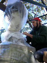
Here's a sample map, extra compressed so that I can sneak it under the bar for this blog... but a taster for the work that has been done.... The format is .png but the real maps are in pdf so they are easily printed anywhere...


No comments:
Post a Comment