Today is the first day of our mapping blitz... how long a journey it will be, and, well, I don't really have any idea...!
The good news is, however, that Google seems to have, in the last 4 months, made things even easier and better... and it already seemed like the possibilities were great... it just may be that we will be making public some wonderful and wonderfully accessible maps to the Anglican & General parts of Rookwood... soon... soonish...!
Here is a little test and maybe a taster of things to come...
I am hoping that you will be able to view the following through your browser... and that it promises live access to dynamic maps if you are walking around with your iPhone, iPad or Android phone...
The first map (which is a draft only and very much the start of a work in progress) shows many of the Sections in the Anglican & General Trusts' area of Rookwood.
View Rookwood Necropolis AGT Sections in a larger map
The second shows the general mapping progress as of February 2010... but should highlight other possibilities in how we may be able to serve information to you!
View Completed Mapping in a larger map

About This Blog
- Monuments in Memoriam
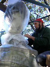
- is a stonemasonry business located in the heart of Australia's largest cemetery, Rookwood Necropolis. Sach Killam, specialist worker in cemetery conservation, has relocated to Australia from Canada to help with the long-term care and preservation of this important historic cemetery. This is Sach's blog...
No comments:
Post a Comment